Technology Offerings
We are creating a geospatial data annotations and analysis platform to enable development of new product categories for governments and organizations interested in leveraging the power of location and maps using technology.
The derivative applications and tools from the platform will bring a paradigm-shift in mapping based use cases and business models.
Mapping
People’s map of the world
We are building a people’s collective to share the profits made from maps and location-based services enabled by people’s location data and annotations. Our focus is on developing offerings for supporting United Nations’ Sustainable Development Goals. QenMaps platform will allow people and organizations to monetize their geospatial data and knowledge while getting assistance from our AI tools to do so more effectively.
QenMaps platform is a geospatial data annotations and analysis platform to enable development of new product categories for governments and organizations interested in leveraging the power of location and maps using technology. The derivative applications and tools from the platform will bring a paradigm-shift in mapping based use cases and business models.
For our government or enterprise customers building and maintaining their own maps, we provide options for a multi-tenant cloud and on-premise deployments. Our mantra is to provide easy configurability and reliability with high-performance. We understand all forms of spatio-temporal data well and building the tech-stack for their ingestion and analyses.
The platform will allow users to create custom maps by overlaying any of their proprietary data as custom map layers and provide seamless integration with annotation tools and any of their own APIs. Our state-of-the-art AI algorithms and crowdsourcing engine reduce annotation, analysis, and mapping costs by a factor of 3 or more.
Sustainability
Soil Health Index and Carbon Stock Management Tools
MITTI is a comprehensive and high-resolution Soil Health Index of world in making. It’s derivative Software As A Service (SAAS) offerings for land managers and investors will enable them to use the best soil health management tools and practices for building a sustainable future. The objective is to not only maintain the inventory of soil nutrient and carbon stocks, but enabling land managers and decision makers to understand and explore options for better manage the health and sustainability of their lands.
Our process allows combining satellite imagery data from public and private sources with ground truth soil health data from archives and through regular in-situ tests conducted based on an optimal sampling methodology that takes into account soil heterogeneity and spatiotemporal variability.

We plan to keep adding novel data acquisition capabilities and field test them along with the full chain of interconnected systems that can generate complementary data and support the integration of space-based and in situ sensing towards the extraction of harmonized information related to topsoil properties.
In alignment with our ethos of sharing returns fairly with the producers data, we want MITTI to be the 21st century co-op or data collective for farmers working on the ground and other producers of the data that serves as MITTI’s foundation.
We envision following practice area for this product:
Soil Health Monitoring
Carbon Credits Verification
Land Lease Pricing
Farm Insurance
Marginal Land Management
Mobility
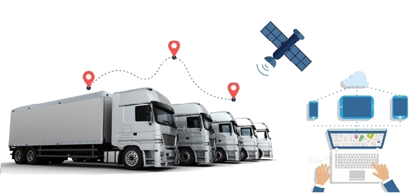
Dynamic fleet management and custom route optimizations for mixed asset fleets. In addition to solving the problems of customers, our system also provides with an option to monetize the data they share with us.
We work with the leading researchers on the spatio-temporal data science and transportation engineering for developing our solutions under this vertical. We have strong capabilities in mining GPS trajectory data for identifying traffic patterns and derivative insights, including map updates using trajectory data. Our AI solutions / offerings are meaningful for both the customers and data producers, while helping deliver:
- Accurate map updates for measuring access and optimizing delivery of essential services, especially in rural and remote areas
- Ecologically efficient routing for electric vehicles based on crowdsourced data on traffic and accurate road elevation profiles
- Urban planning inputs for sustainable and equitable cities


